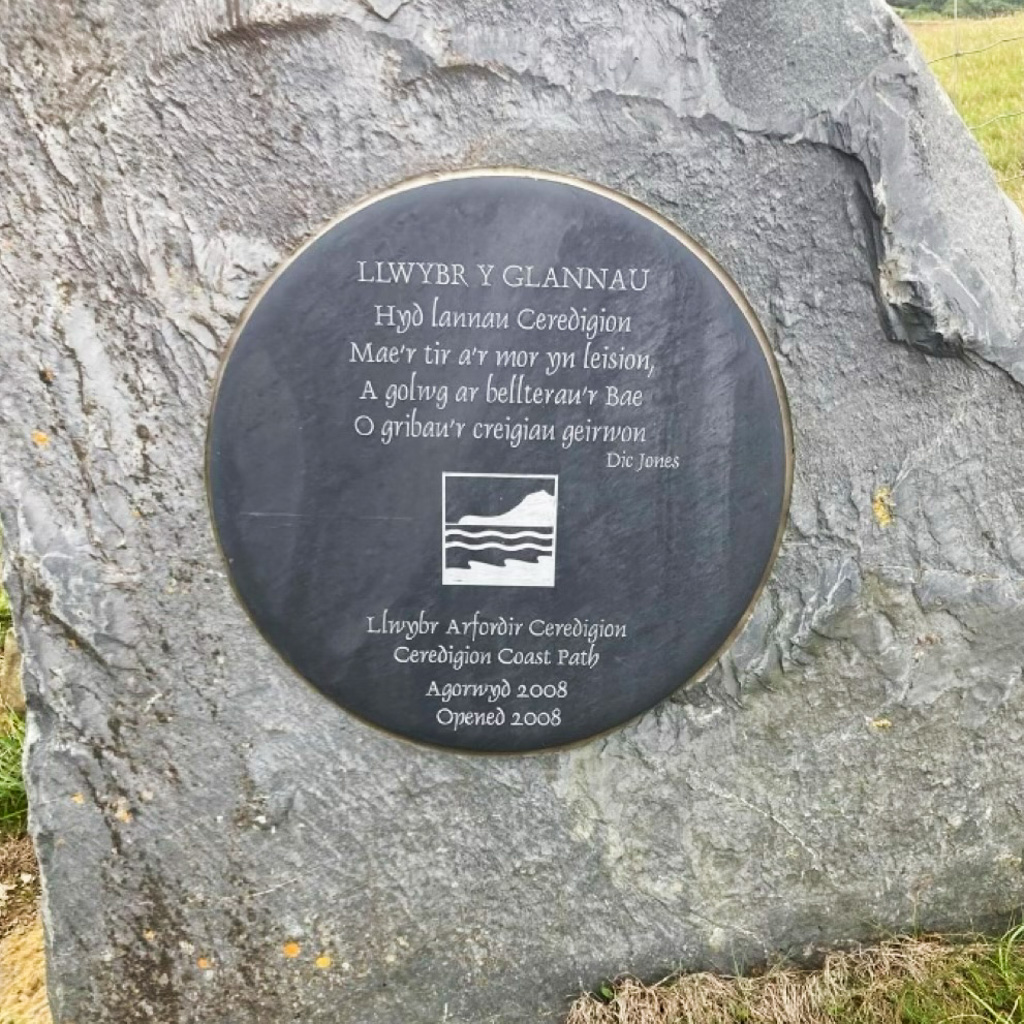
The Ceredigion Coastal Path is one of Wales’ best-loved hiking routes, a stretch of well-marked clifftop walking routes reaching all the way from Aberteifi (Cardigan) to either Ynyslas or Machynlleth, depending on who you ask. It’s also often combined with the Snowdonia Coastal Path, which extends right up to Porthmadog on the edge of the Llŷn Peninsula. In fact, the whole of Wales’s coastline is marked for walkers (known as the Wales Coast Path), meaning you can choose any of this country’s beautiful beaches as a starting point for a hike.
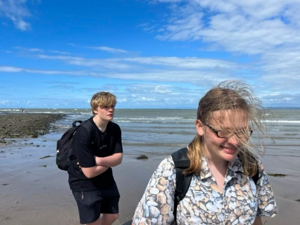
So what makes Ceredigion so special? Well, it’s generally considered one of the most varied sections of Welsh coastline, and its considerable length means you get to experience views of both Pembrokeshire and Snowdonia at different points on the walk. Plus, it’s one of the best place for spotting wildlife like dolphins and seals. I’m hoping my diary of my experience walking a section of it with my wife and brother will prove to you just why it deserves to be so popular!
Please note this route was traced afterwards on a computer and not recorded via GPS, so some sections might be inaccurate. It is intended as a preview only.
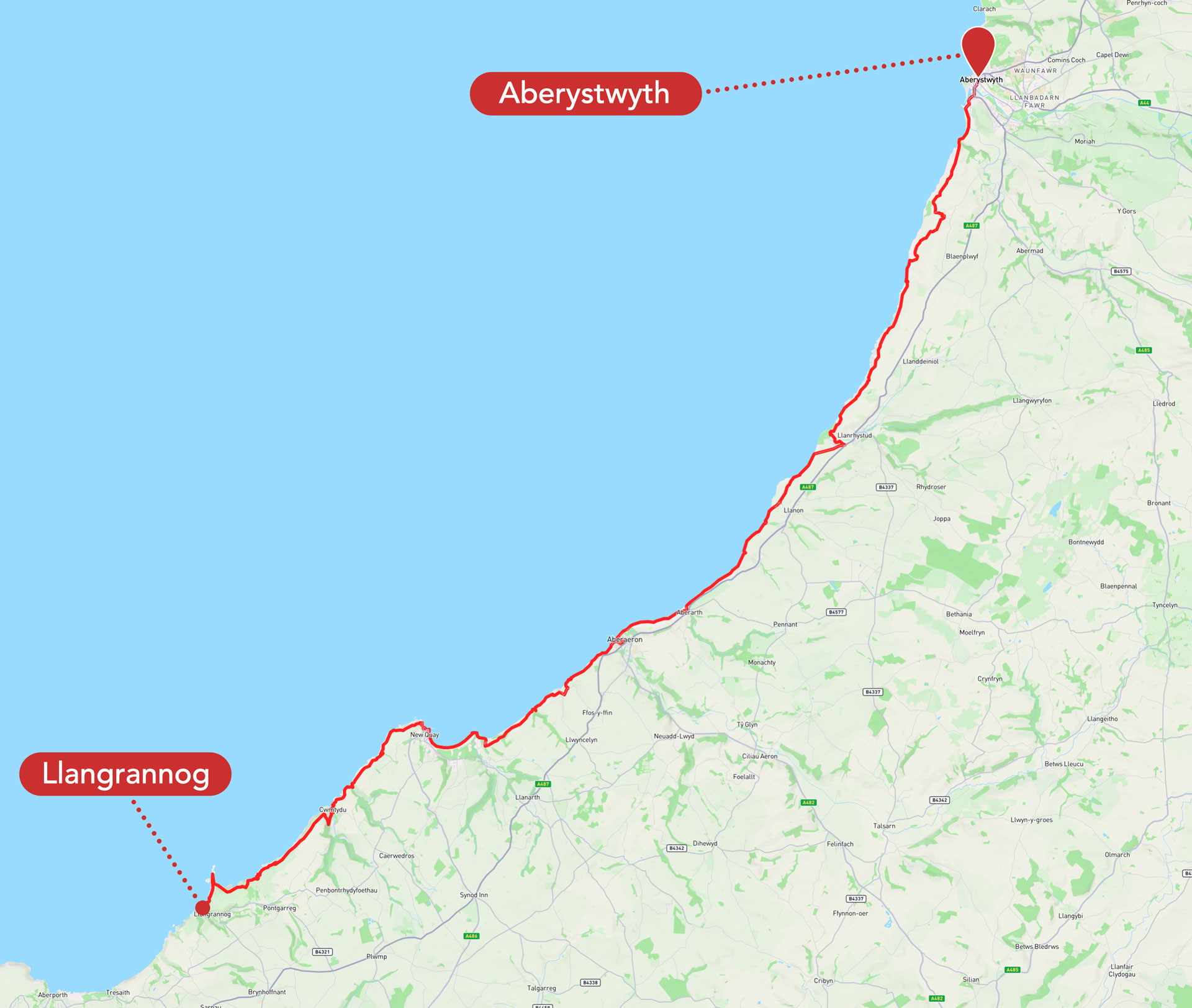
The Aberteifi to Ynyslas route is generally divided into seven smaller sections of roughly five to seven miles each. Most walkers allocate a day to each of these, giving plenty of time to take it easy on the intimidating ups and downs, take breaks, and enjoy the local scenery and history. We were a little more ambitious and aimed to walk from Llangrannog to Aberystwyth, which is four sections of walking, in just two days.
Perhaps this was a little too ambitious for very inexperienced hikers! Still, the two days we did spend getting from Llangrannog to Aberystwyth, with an overnight stay in Aberaeron, were well worth the blisters and sore backs. Read on for our favourite views and top tips for navigating this gorgeous stretch of Welsh coastline – whether you’re an amateur like us or a seasoned rambler.
Llangrannog to Newquay
Having been staying in Llangrannog for the week preceding, our motley band of would-be walkers were able to depart with a spring in our step and full lunchboxes from this lovely seaside village’s main beach at 8am on the first day.
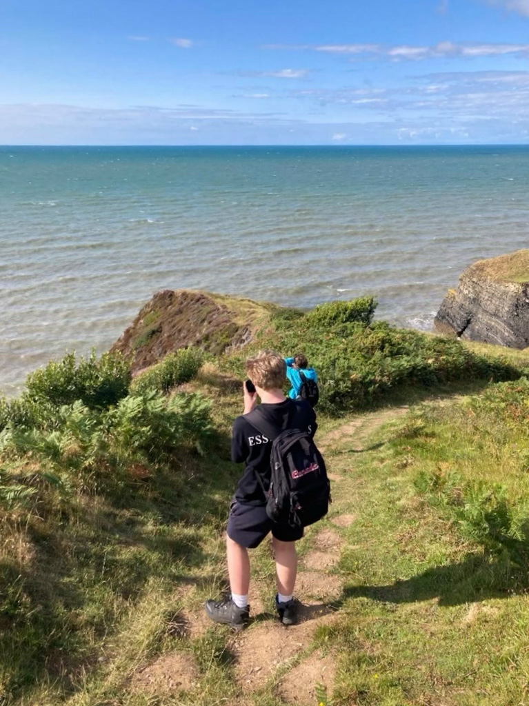
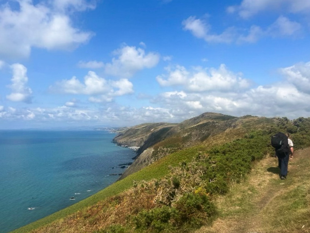
After a steep ascent from the beach, the first forty-five minutes or so were spent walking along the clifftops of Llangrannog itself towards the Elephant’s Trunk peninsula and Ynys Lochtyn, a small island at the end of it. Several of Llangrannog’s smaller beaches and coves were visible from above.
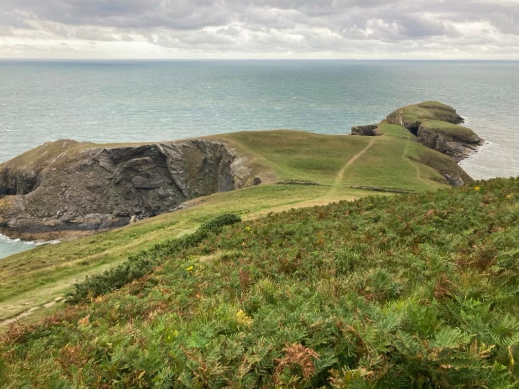
This was difficult terrain – there were lots of up and downs, it was rocky and insecure underfoot, and at several points we were walking very close to the cliff edge. Of course, the upside to this was the pure clarity of the views out over Cardigan Bay. We were very lucky at this point that we were having our bigger overnight bags dropped off for us in Aberaeron, and wouldn’t need to be carrying them until tomorrow!
Now on a much wider and grassier path.
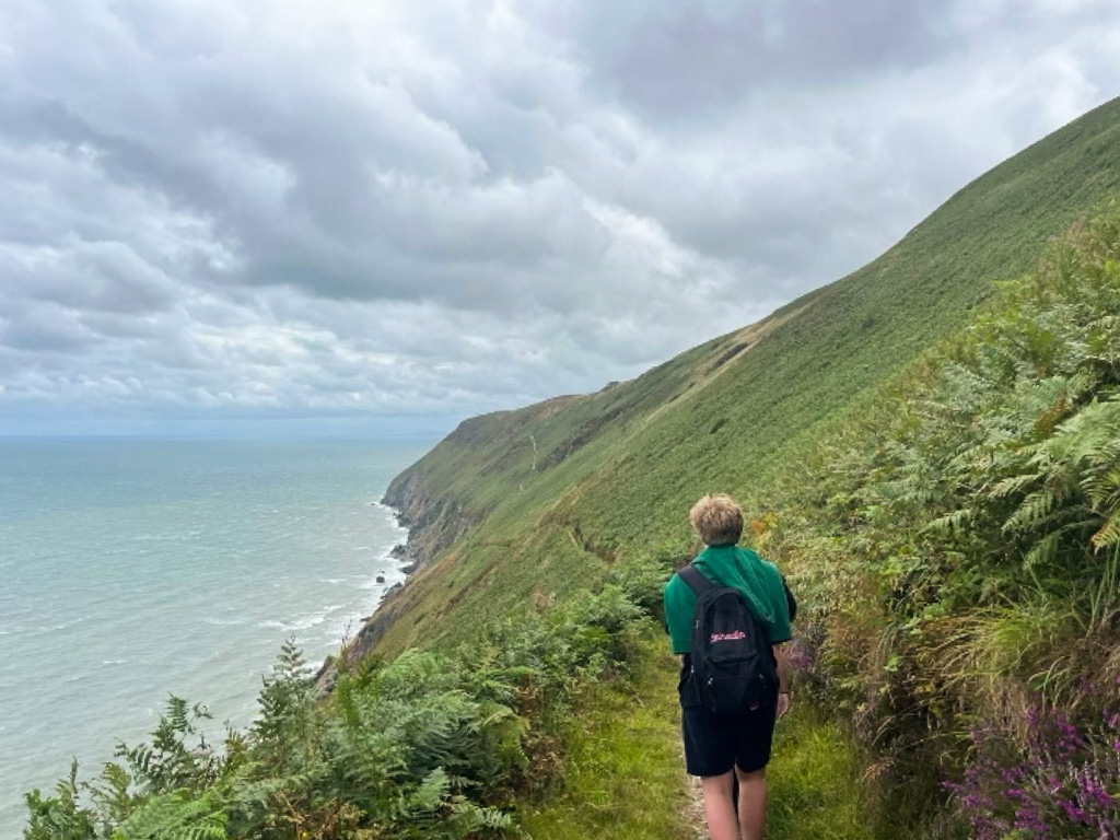
Surrounded by slopes of bracken above and below, we continued onwards, enjoying spotting signs marking out the coastal path along the way.
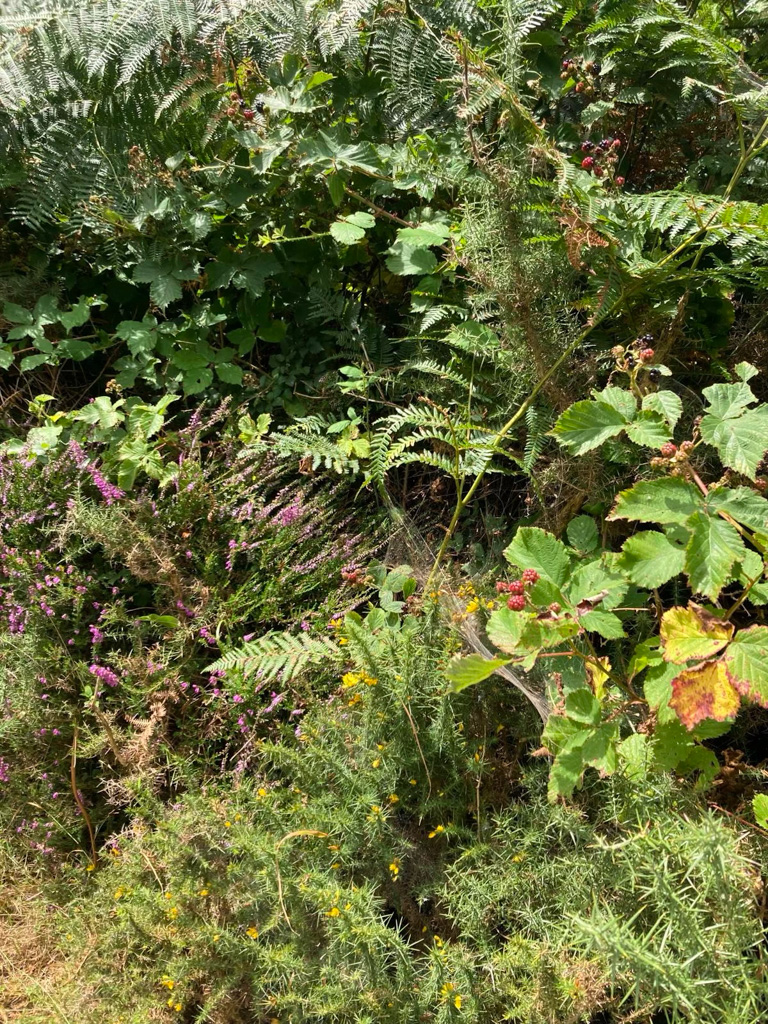
This stretch of the walk was one of my favourites – the earth underneath was reddish, the path was lined with blackberries and yellow and purple flowers, and, if you turned away from the sea, there was a great view inland, endless rolling fields of sheep and sometimes horses.
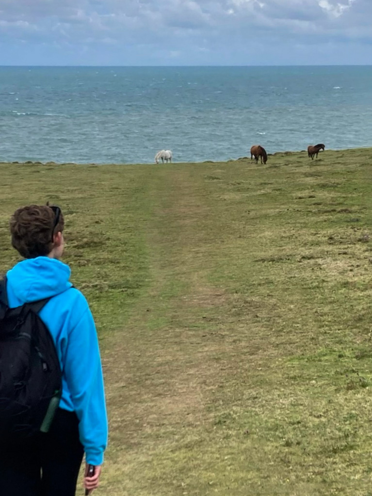
We also passed by two very pretty Welsh mountain ponies, though we were careful to give them their space.
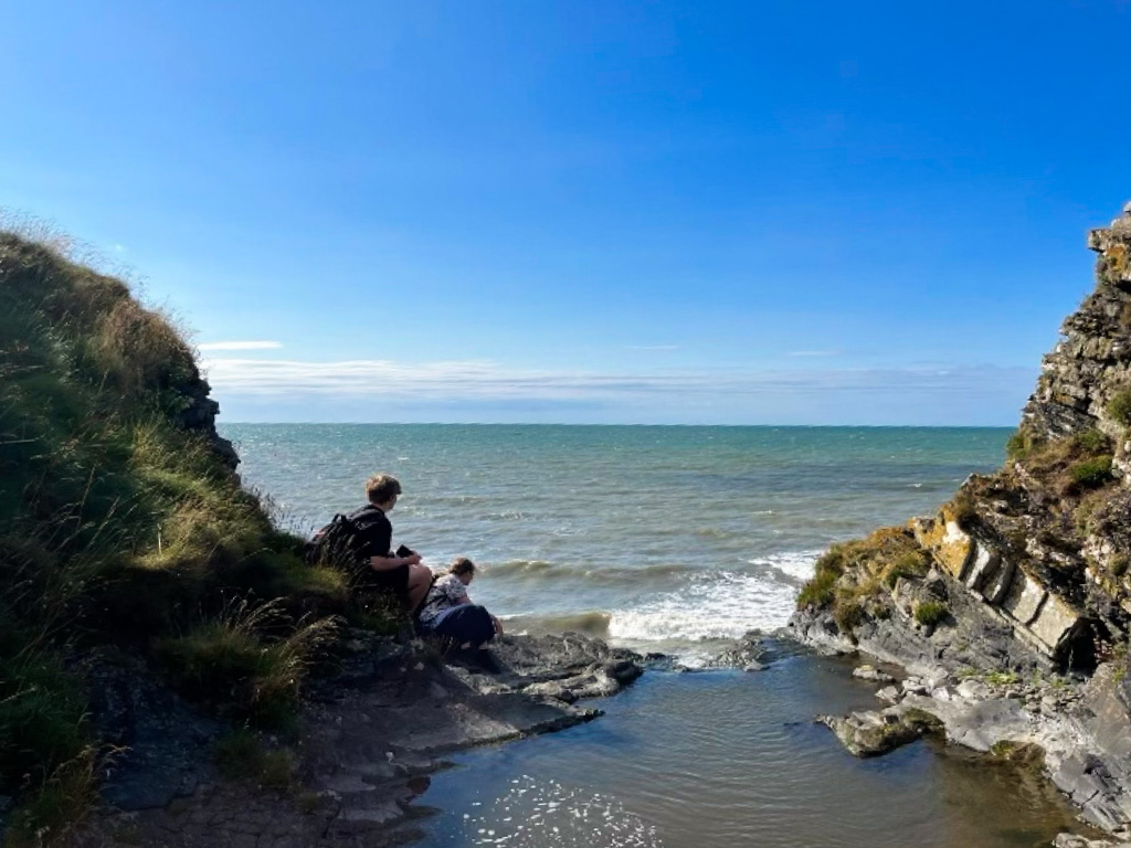
At around 10:30am, we veered sharply inland and down through gentle woodland towards Cwmtydu, a tiny village set in a charming cove where the river Drywi flows into the sea, known for being a hotspot for smugglers in centuries past. Cwmtydu made us very happy for two reasons. Firstly, as we entered, we noticed a signed aimed at travellers walking the other way, warning them that the section between Cymtydu and Llangrannog was the most difficult and treacherous of the whole Ceredigion Coastal Path. It was good to know we had that behind us!
Secondly, as we sat and rested on the stony beach, a curious grey seal popped its head out of the sea. It came incredibly close to shore and stayed watching us and bobbing up and down for over half an hour, until eventually we had to get going again. We couldn’t believe our luck.
Though ascending after Cwmtydu was predictably difficult, steep and stony – plus we kept pausing to see if we could still see our seal friend! – the next part of the path was again broad and level. The grass was a brilliant green dotted with purple flowers, and we got lucky again, passing through another, larger, group of Welsh mountain ponies.
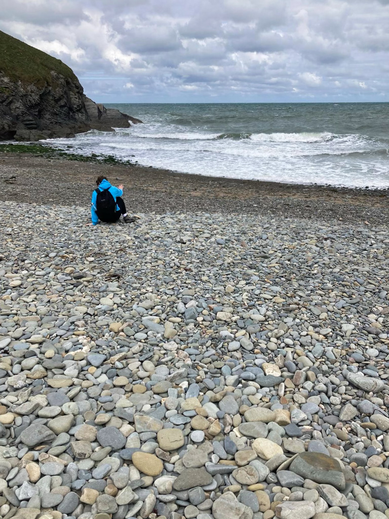
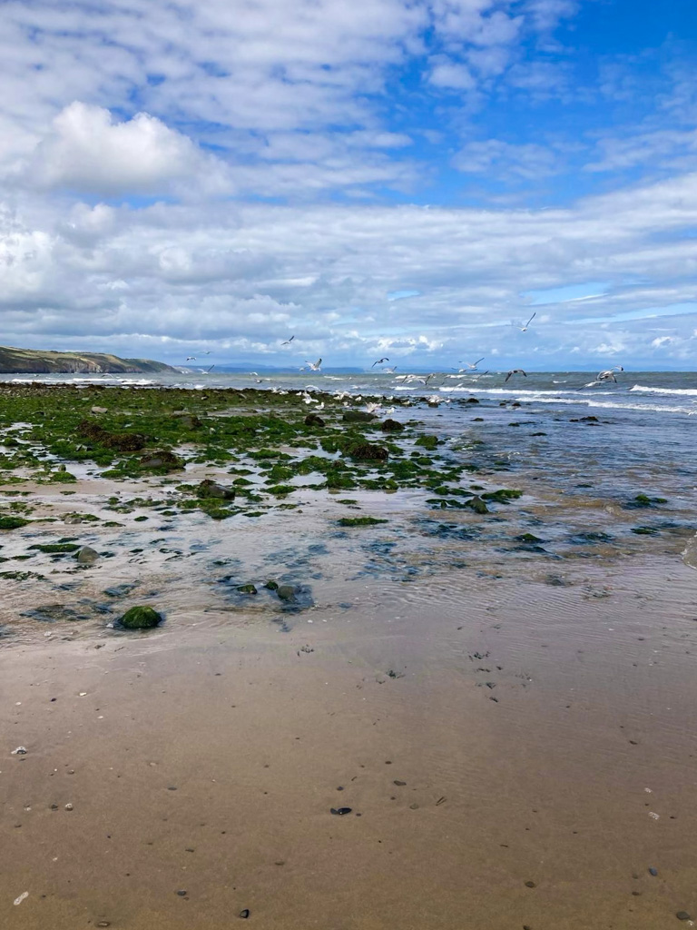
There were several points at which we could have descended onto a rocky beach below for a break but we were determined to press onwards knowing we’d need a longer rest later, though there was one beach at which climbing downwards and back up again was unavoidable. The beach itself, which we later discovered was called Traeth Soden, was very peaceful, and beautiful enough that we couldn’t complain about the hike back upwards afterwards.
It wasn’t long after that that we reached Newquay, although we were able to stop at what I assumed was a coastguard’s lookout, surrounded by vibrant yellow gorse, just beforehand to eat our sandwiches. We’d hoped to stay for a while and dolphin-spot, but it was far too windy!
The walk down into Newquay was long but easy. We arrived just after one – though I should say that the entire walk would likely have taken many people a much shorter length of time, since we walked slowly and took a lot of breaks – and spent an hour enjoying hot chocolate and cake at Mariner’s Café.
Newquay to Aberaeron
Leaving Newquay we were very excited – we’d heard Newquay to Aberareon is one of the most popular parts of the walk. It’s true that the section of the path immediately after leaving Newquay is one of this walk’s most interesting, because for up to an hour you’re actually walking along the beach. Though this mean you have to time it carefully – you wouldn’t be able to walk along at high tide, and you’d have to walk on the road further inland, which is disappointing. (You can check information about tides on tide times.)
Newquay beach is incredibly long, with calm waves and lovely vegetation behind you, and you’ve generally got a good chance of spotting dolphins (although we sadly didn’t).
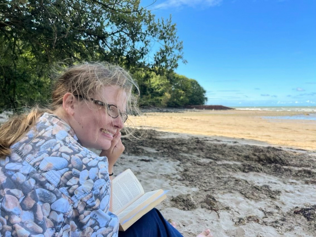
At the end, we paddled through the mouth of the Llethi River – it was very shallow – and rounded onto a second beach, that of Llanina.
This one was even lovelier and though we probably shouldn’t have timewise, we couldn’t resist stopping here for another hour to read, splash around in the shallows, and generally enjoy the almost tropical vibes of the unspoilt sand and low-hanging trees.
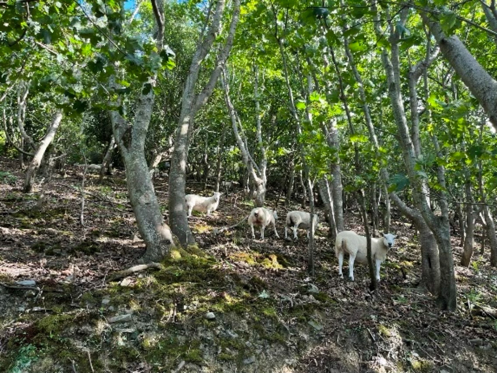
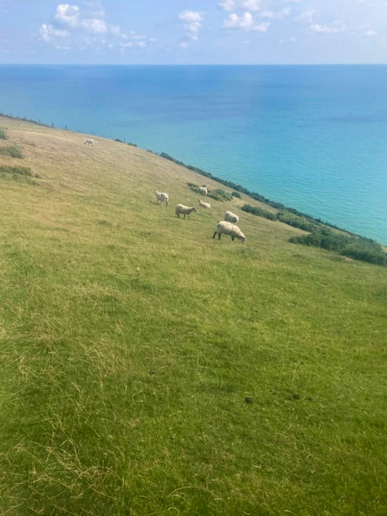
We veered inland for a little while and enjoyed befriending some curious sheep grazing woodland on one side of the path.
Then the trail took us out towards the sea again, and the next hour or so of walking was untroublesome, with another long stretch of wide, flat, grassy path.
We then had in quick succession two of the most memorable experiences of the entire hike, albeit one for much more pleasant reasons than the other!
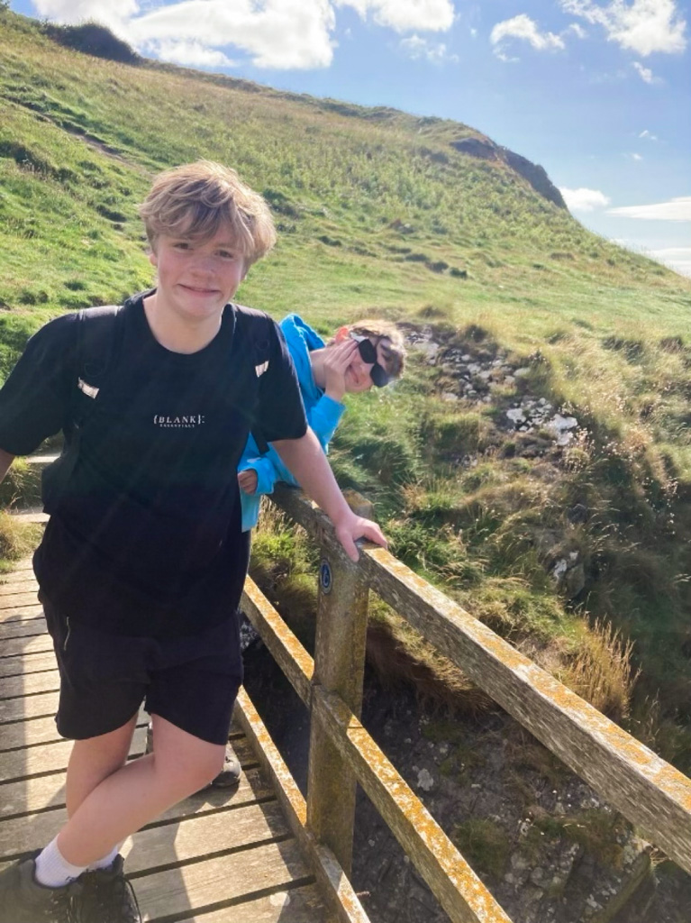
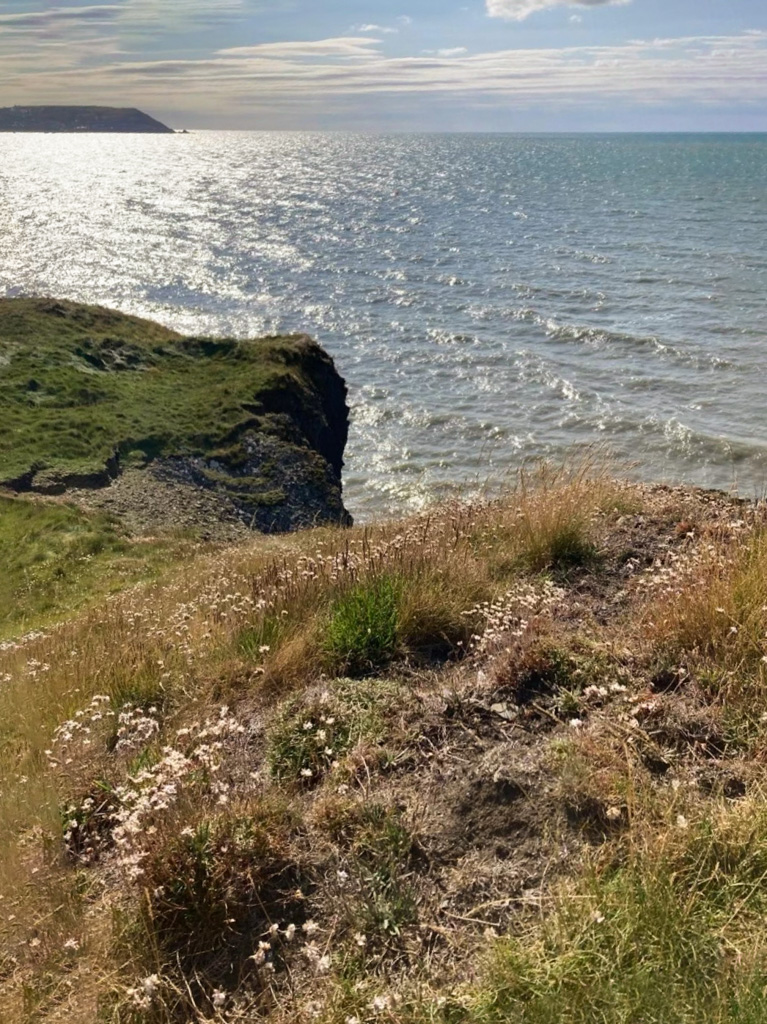
Firstly, we crossed a small bridge over a stream that seemed to run directly off the cliff edge and into the sea.
Curious, we attempted to climb down from the path into the stream and move closer to where it disappeared over the edge.
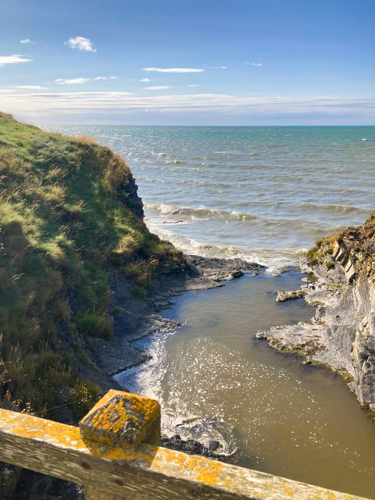
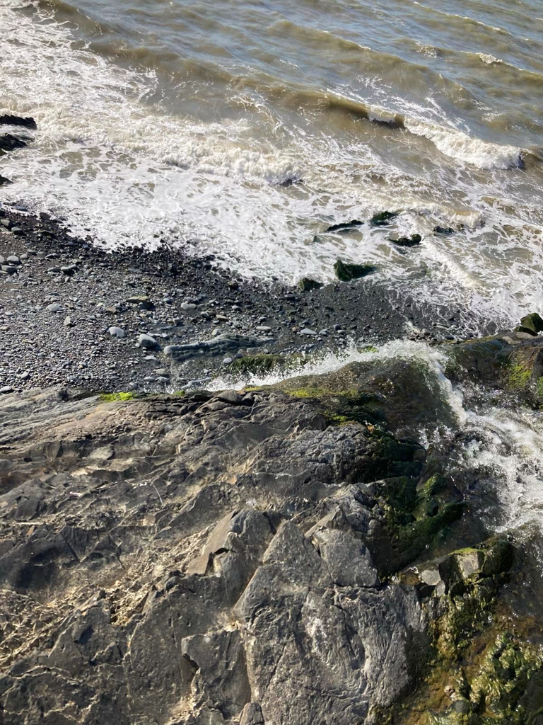
There were an abundance of large smooth rocks on each side of the stream that we could shuffle across, so we didn’t feel in any particular danger, and it was well worth it because when we did get to the cliff edge, we got a fantastic view of the stream turning into a waterfall and falling onto a rocky cove below, from where it ran into the sea.
It was truly magical – I’ve tried and failed several times since to figure out if this spot has a name! It does match one picture of Gilfach yr Halen that I’ve seen online, but I’m not 100% sure that there aren’t just several of these wonderful spots on this stretch of the path.
Secondly, there was a section of path shortly after this that veers very, very close to the cliff edge. Just before you cross this path, there is a sign warning you of this and giving an alternate option going slightly inland. We made the decision to take the primary path, but having done it I wouldn’t recommend it. The cliff has clearly eroded considerably since the path was first marked out and this was the only part of the entire walk where I felt genuinely unsafe. I was clinging to the hillside for dear life! It may feel annoying to have to go inland, but you’re seeing wonderful views of the sea across the entire trail so there’s no need to feel like you’re missing out.
After another hours or so of beautiful hillside vegetation and ocean views, we finally reached Aberaeron at 7pm. Now, before coming into Aberaeron, there is an opportunity to scale the hill opposite the sea and reach Henfynyw, built on the site of a monastery at which St David may have spent part of his childhood. We didn’t have time to visit, but would like to if we did the walk again.
We’d made much better time on the second part of the walk, having only left the beach at Llanina at after four. Since we were doing two sections of the walk in one day we did feel that our long breaks and leisurely pace were probably necessary overall to conserve energy, but I certainly wouldn’t expect it to take eleven hours to do this journey for most people.
By this point we were exhausted and very much looking forward to eating, showering, and getting some rest. We stayed at the much-loved Castle Hotel, and after putting down our bags we were up to a brief walk around town and grabbing some chips and curry at Llond Plât, a wonderful takeaway and restaurant in the town centre.
Aberaeron to Llanrhystud
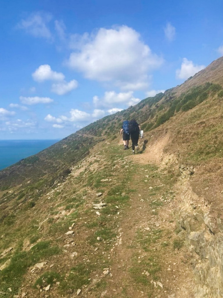
We were in a considerably less pleasant mood leaving Aberaeron at 9am the next day, knowing that from now on we’d have to carry our unreasonably huge backpacks. We walked from our hotel down to the harbour, stopping to pick up some supplies for the day ahead at Costcutter. From there, the first hour or so of the onward walk was very flat and close to the beach until we reached the hamlet of Aberarth. We took a longer break than we probably should have at the beach by Aberarth to give our backs a break – and also enjoyed foraging some wild blackberries.
From Aberarth onwards, the path climbs again, though this was fairly slow compared to the dramatic ups and downs of the previous days.
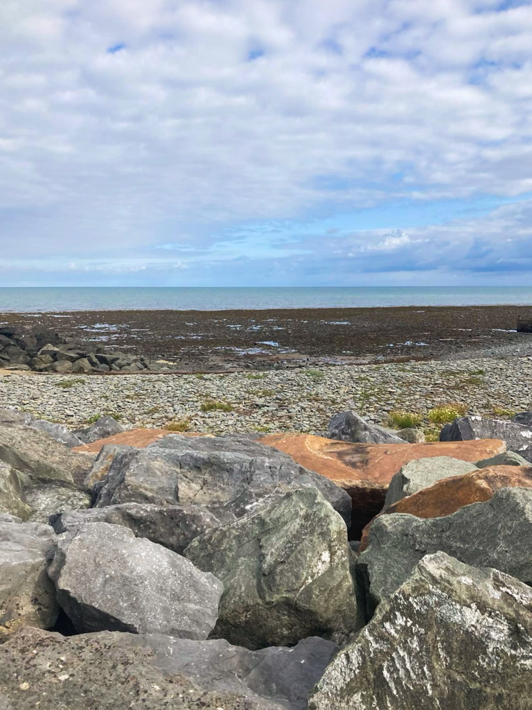
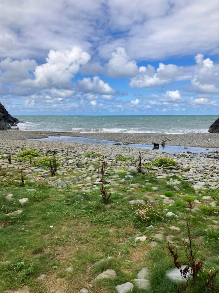
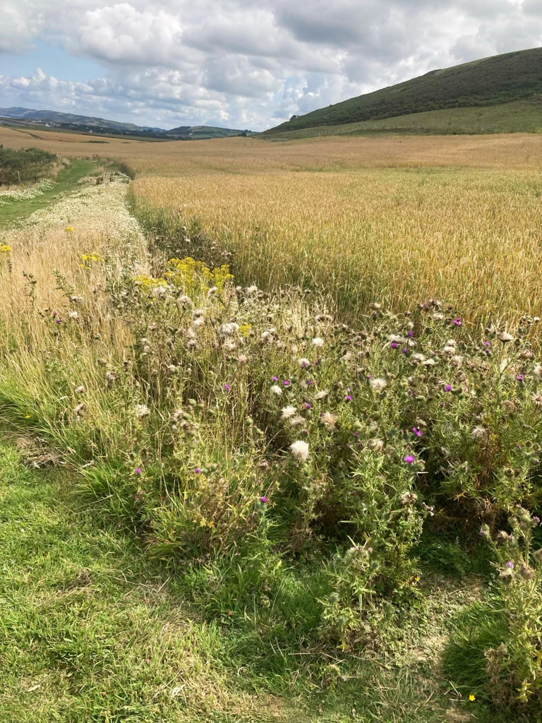
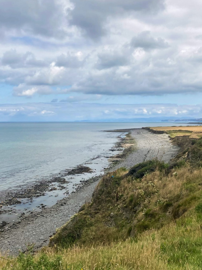
To our left were endless stony beaches, strewn with huge rocks and brown seaweed, and to our right were cheery fields of wheat, lined with wildflowers.
When we did eventually get to a higher point on the clifftop it was similar to much of the path between Newquay and Aberaeron – well protected by hedgerow and bracken, and fairly easy underfoot.
It was far less high than any part of yesterday’s trail, however, and this was generally the case for all of this day’s walk.
Eventually we reached Llanon, where we chose to take our midday stop early, rather than waiting for the recommended midpoint of Llanrhystud. This was perhaps not a good choice in terms of rationing our rest time, but it was certainly a good choice in that we got to stop at Rockin Robin Records and Tearoom, a lovely, quirky shop offering a selection of records and antiques, as well as tea, soft drinks, and cake. We got there at 11am and spent an hour (also taking the opportunity to reapply suncream!)
I’d never visited Llanon before and was very glad we did – this is another place where there are two options on the path, one of which stays closer to the sea and doesn’t go into the town at all, and it would have felt a real shame to have missed it.
Luckily, from Llanon to Llanrhystud – the walk’s true midpoint – didn’t take as long as we expected, and was also quite a fun walk. Leaving the village and getting back to the main coastal path was around half an hour’s walk, after which we continued on between a crop field which separated us from the cliff edge, and cows on the other side.
After stopping to enjoy yet another flat stony beach, we walked past some fascinating old limekilns in the cliffside, surrounded by vibrant vegetation – they looked more like buildings out of a fairy tale than they did snapshots of pre-industrial history, and the framing of trees bowing to meet overhead only reinforced this image.
Llanrhystud to Aberystwyth
We didn’t stop in Llanrhystud (which constitutes another inland detour) as by this point it was already nearly 2pm, but there is a pub with overnight rooms for those who are planning to do the walk in shorter chunks.
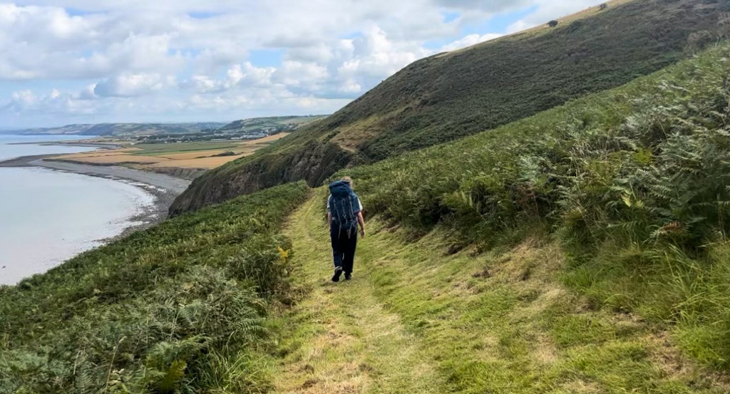
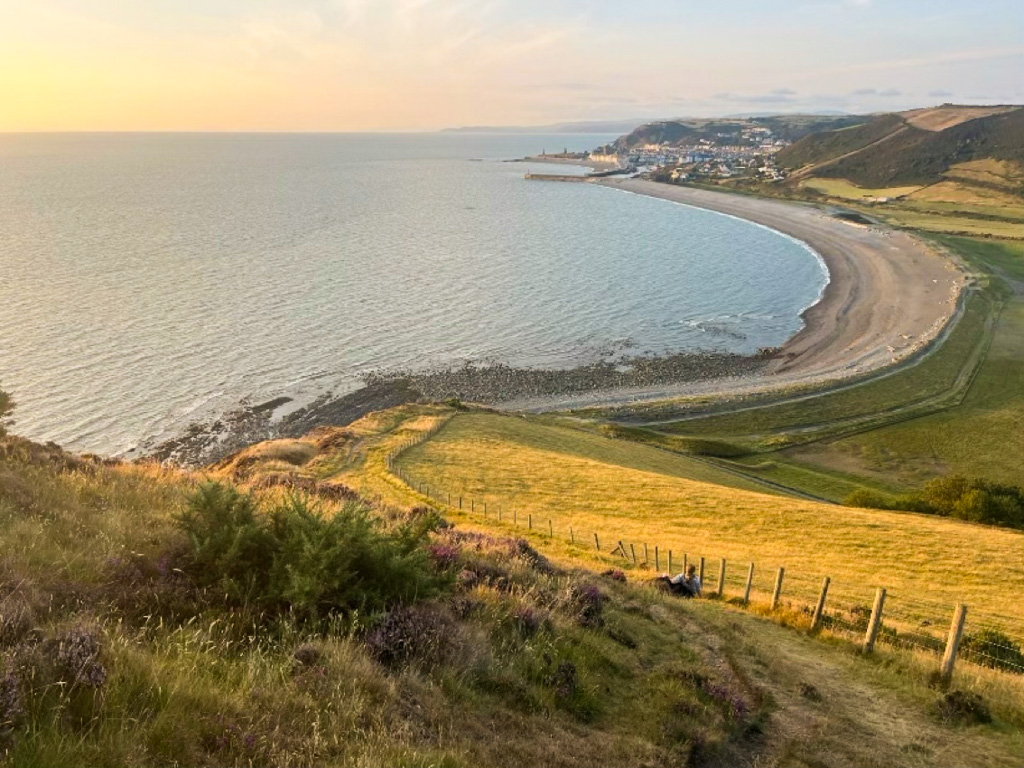
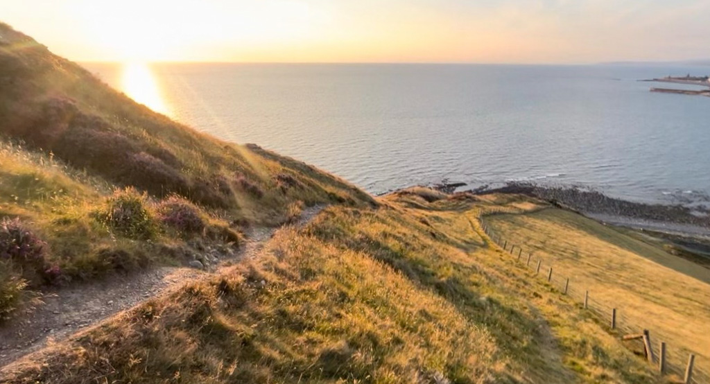
Onwards was a sharp and steep ascent to much higher cliff edges with some of the most glorious views of the sea we saw on our whole journey, made even better by the fact that the sun was out in full force, creating colourful patterns on the water. We later found out that this is the Penderi Cliffs Nature Reserve, known for its seabirds.
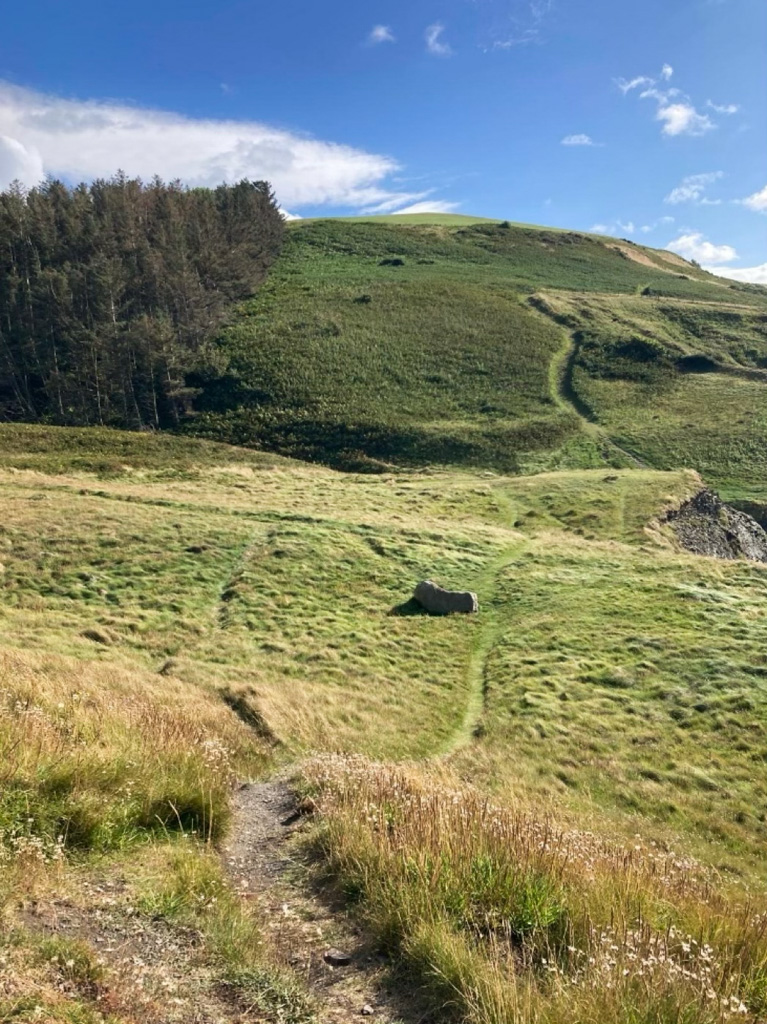
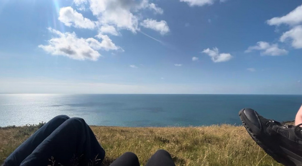
From here on out the path wound back and forth over hilltops amongst gorse and long, dry grass, and we stopped at around 4pm for a long rest in the baking sun and to finally eat our pack-lunches.
Of the entire walk, the final stretch towards Aberystwyth was by far the least interesting. We were mostly walking through sheep fields quite far from the water and it was also quite hard to keep to the path, meaning we had to double back on ourselves several times.
The terrain was also deceptively difficult, especially with our bags. It was grassy not stony, but there were lots of little ups and downs that took their toll on our calves over time.
Overall the second day was a lot less dramatic and varied than the first in terms of natural beauty, but there were still some really magical spots along the way.
Exhausted as sunset approached, we were very happy to spot Aberystwyth itself approaching in the distance.
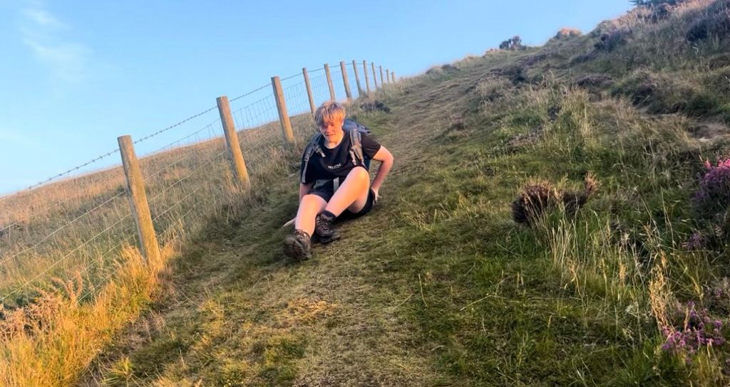
Though it was very difficult to actually get down off the cliffs into the town – after some nice walks over gorsy hilltops that reminded me of Scotland, there was an incredibly sharp descent onto the beach.
Still, it was really beautiful, especially given the sunset, and we managed to navigate the steep downhill by sitting down and shuffling most of the way!
We enjoyed the final half an hour or so, walking along Aberystwyth beach and through the town. It was very nice to be back on flat terrain!
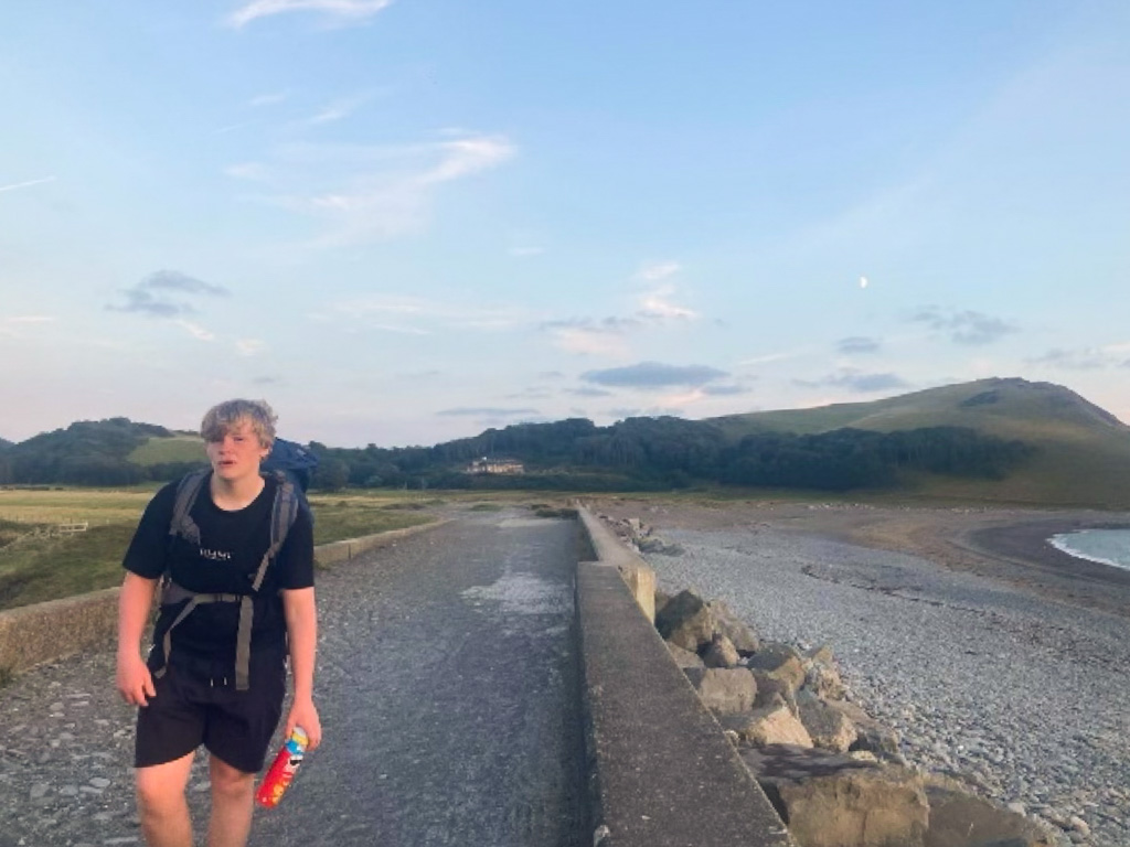
We cut it close to the bone by checking into our hotel, GwesTY Guest House Aberystwyth, at 9pm, but luckily they had self check-in available, and their rooms were very luxurious, which felt like just what we needed! Our shoulders were aching and blisters were beginning to develop… but we were also very proud of ourselves.
Overall, our experience of the Ceredigion Coastal Path from Llangrannog to Aberystwyth was that it is well worth the praise it gets. If we did it again, I think I’d insist that we take the recommended time of a day for each section of the path. That way we’d have had a lot longer to enjoy Aberaeron and Aberystwyth, the seaside towns we were staying in. I’d also be very keen to explore the other sections of the route, south towards Cardigan and north towards Machynlleth.
The beauty spots we came across were breathtaking. From seeing a seal in the wild at Cwmtydu beach to watching the sun set over Aberystwyth, there wasn’t a single moment we would have missed. It is definitely not a walking path to be taken lightly, and the terrain was generally steeper and rockier than we expected. My biggest piece of advice for anyone planning to do any part of the coastal path would be to leave more time than you think you need – we did, and we were very glad we did. You don’t want to be too rushed to be able to enjoy any of the fantastic views you’ll come across, or to take a break when you need one.